Departure: Pieve Santo Stefano
Arrival: Sansepolcro
Distance: 36 km
Ascent from Departure: + 1,132 m
Descent from Departure: – 1,510 m
Difficulty: very difficult
Terrain: gravel & asphalt road; earthen trail
Length: 10 hours
Potable Water: yes (Passo di Viamaggio, la Montagna , Eremo di Montecasale)
Rest Stops: yes
Signage: yes (red & white CAI; vertical red & white with black Tau on yellow background)
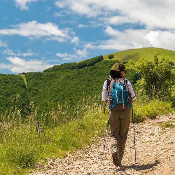
Depart from Piazza delle Logge del Grano taking Via delle Antiche Prigioni, which crosses a bridge over the Tiber River. At the end of the bridge (km 0.2), take care: the signage directs you to turn left, where there is a rather difficult marked trail through the woods. Instead, we suggest you turn right onto an unmarked but asphalted road, continuing until you reach the Church of Madonna dei Lumi. After passing the church, you arrive at a traffic circle; take Via Canonico Coupers. Continue along the side of this asphalted road, turning left at the brown signage for “Cerbaiolo” (km 1.2) and following the road as it climbs. At the fork (km 4.73) marked by a cross, begin climbing towards L’Eremo di Cerbaiolo. After about 600 meters, there is another fork (km 5.24); from here pick up the marked trail. Those interested in visiting the Eremo del Cerbaiolo need to take the steep climb to the right for 1 km; those who wish to continue on, stay left on the steep climb towards “Viamaggio – Sansepolcro – Assisi”. At Poggio delle Calbane, 800 MAMSL, continue climbing. At the fork (km 6.5) stay right, then keep right again soon afterwards at the crossroads for “Passo di Viamaggio”. Pass Fonte delle Rupine and, at the crossroads with the red and white signage (km 7.18), turn left. Continue, keeping close watch for the red and white painted markings. Pass through the gate (km 7.53) (if you find it closed, remember to close it behind you again after passing through) into the meadow; walk the length, passing a large tree on the left. At the far end of the meadow, take the tractor track which climbs to the left and offers views over the Montedoglio dam. Passing through a gate, continue to the signage (km 8.18) for trail “02” and “Viamaggio”. The trail comes out near a shed for livestock (km 8.48); take the tractor track on the right, passing a gate and trough on the left. The landscape becomes alpine here. After reaching a yellow building (km 9.4), follow the signage to the left for the rigorous climb to Passo di Viamaggio, 983 MAMSL (km 9.8). From here, take the road on the right which descends to the cafè/restaurant where you can purchase food and water. Take the internal alley to the end of the building, then climb to the left until reaching a metal fence. Turn left here (keeping the fence to the right). At the corner of the fence, follow the painted markings, making a hard right onto the trail running parallel to the fence. One of the toughest climbs of the entire route begins here. Use caution; the path is slippery when wet, so hiking poles are recommended. The trail runs through a thick wood along another fence. After passing over the gate using the wooden steps (km 10.2), follow the trail as it climbs slightly to the left and then skirts the metal fence. At the end of the fence, pass through the gate to the right and then climb to the left.
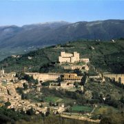
Climb along a barbed wire fence until passing through a gate (km 10.56). The view here opens up, and after another 100 meters you’ll find painted signage for trail “00”. The trail leaves the barbed wire fence behind and instead leads to a scenic overlook which is the perfect place to drop your load for a few minutes and catch your breath. Continue towards the highest point of the rock facing the valley, beginning to descend to the left (the trail markings are on the ground) and then taking the trail that continues to the right. After walking downhill, begin climbing (km 10.90) until reaching the painted signage, where a steep climb along a barbed wire fence on the left begins. After the pass (km 11.5), you reach the top of Monte Verde, 1147 MAMSL, a wide expanse of meadow overlooking the Sansepolcro valley. Begin to descend on the left toward a barbed wire fence, keeping it to the left. After about 300 meters, pass the gate and begin descending toward the right, skirting the fence (be cautious; the trail is slippery when wet). The worst of this leg is over; from here the walk is much more pleasant. At the crossroads (km 12.2), turn right on a wide tractor track, following the signage for “Sansepolcro”. Keep left and follow the main track of trail 00 which curves to the right toward Pian della Capanna. At Collepegli, 1047 MAMSL, (km 14.2) continue on the tractor track 8 B. The route passes between the rocky mountain slope and open fields. After about 1 km, you will enter the Riserva Naturale dell’Alpe della Luna. At the fork, veer right following the painted signage. In less than 1 km you will reach the rest area at Pian della Capanna (km 16.4). The route continues downhill for another 1.8 km through beech, oak, and hornbeam woods. Don’t take the fork for marked trail “8” but instead continue towards Aboca and Sansepolcro. When you see a farmhouse with a red tiled roof in the distance, La Spinella (a good place to break up this leg, if you choose), slow down and look carefully for the marked crossroads (km 18,8) for “Assisi – Germagnano – REV 11”. Leave the wide track here and head toward La Spinella; turn left while descending to pick up the trail markings again. This alternate route for La Montagna or Villa makes the route a bit easier. From the crossroads, continue for about 4 km without deviating from the main track. Pass the rest area with places to sit, Val di Canale, arriving in the town of La Montagna (km 23), a possible intermediate place to stop for the night.
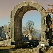
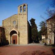
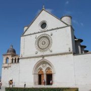
Descend through the town until reaching the war memorial, where you will begin climbing to the left along trail 00 toward a group of houses. Pass the church of San Michele Arcangelo on the right. Soon after, you will reach Pischiano (Km 24.3), where you will turn right at the spring following the signage for “REV 10” and then descend to Montecasale. Continue straight making a steep but short climb. Continue on a rolling, picturesque trail cut from the rock. After 200 meters, pay close attention: you will need to turn left, climbing to the next trail marker which you will find on a tree trunk (km 24.7). Here, turn right and begin descending. The route continues, levelling out through brush over which the view over the horizon widens. Pass a pretty waterfall (km 26) and, at the stream (km 26.5), follow the signage to cross without getting wet. After having passed a spring, continue to the meadow (km 27.2); here the trail leads into a tractor track. At the crossroads, continue straight following the painted markings. After roughly 800 meters, pass through a barricade to the Eremo di Montecasale (km 28.6)—another good spot to break up this leg– where there a bronze statue of Saint Frances and a precious water fountain greet you. With the statue behind you, descend to the right, passing through a gate and reaching a path marked with the Stations of the Cross; begin climbing to the left. Near the convent gate, descend to the right toward Sasso Spicco and Sansepolcro. At the crossroads, follow the signage for “Sasso Spicco”, descending along a steep and narrow trail. At the next crossroads, turn left. Continue under the shade of the thick woods, turning right after 150 meters, and then immediately left (caution: the ground is slippery when wet). Continue descending along the stream. After passing a small ford (km 30), continue on until you reach a small country church (km 30.6), with a water fountain. Continue until you reach the crossroads; turn left towards Sansepolcro on the asphalted road. From this point on, the route is entirely asphalted. Ignore the verticle signage (km 31.7) directing you to turn right, and continue instead along the main road. Pass the San Francesco Bridge on the Afra River and continue until you reach the intersection with the busy Via dei Montefeltro (km 34.4). Cross and continue toward the pharmacy. Continue along Via dei Molini until the stop sign, where you will turn right to reach Porta Romana and, soon after, the Duomo di Sansepolcro (km 36).
Alternative Route through the Valley
Those who wish to avoid the steep stretches along this leg can follow the Provincial Highway 77 from Pieve to Sansepolcro. Be careful of traffic along this much shorter (19 km) and easier alternative.


